Demarcating China’s Imaginary Valleys

 On October 23, India and China signed a border defense cooperation agreement in Beijing’s Great Hall of the People. The agreement aims to prevent confrontations between the two countries’ patrols as they move along the unsettled border between the two nations. This is an important step towards settling the boundary disputes between the two countries; however, the ten-article agreement does little to clarify the Line of Actual Control (LoAC), the ceasefire line that is as close as China and India get to an international boundary. Articles VI, VII, and VIII each explicitly refer to “areas where there is no common understanding of the Line of Actual Control.”
But earlier this year during a three-week standoff near Daulat Beg Oldi, China never recognized that it had crossed into Indian territory despite having established a base at least ten kilometers past the LoAC. Under the new rules, the People’s Liberation Army would have been able to claim the area as one without common understanding, effectively removing any repercussions regarding incursions over the LoAC. The new rules solve part of a problem given that such incursions occur over a hundred times in any given year. But nonetheless it is delimitation that matters most in the Himalayan border region.
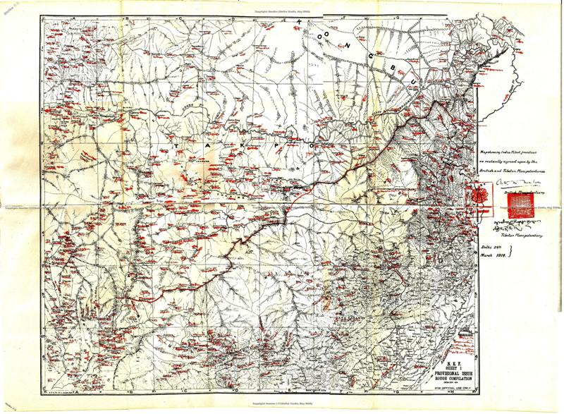
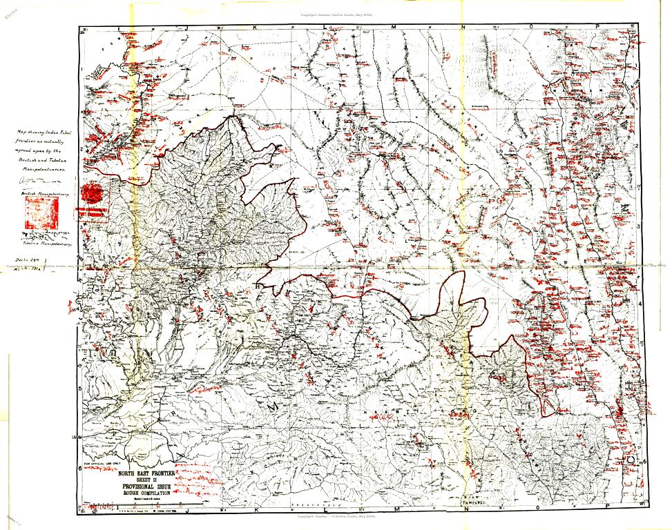
The Line of Actual Control more or less follows the so-called McMahon Line, which was established by the British during colonial rule. Meant to delineate the boundary between British India and Tibet, the agreement was never fully ratified and therefore lacks legal validity. India depicts the boundary with China based primarily on the initial map series that originally depicted the McMahon Line. These maps lack high levels of topographic accuracy, while the treaty accompanying them contains no descriptions of the geographic features the line is intended to follow. India takes the intent of the treaty to be to follow the highest peaks of the Himalayas and has adjusted its depiction of the boundary as more advanced cartographic techniques have shown these peaks to be elsewhere. From the Chinese perspective, this unilateral reinterpretation of the boundary looked a lot like an attempt on the part of India to grab land from China. China for its part adheres strictly to their original depictions. These two interpretations of the border have never reached a satisfactory conclusion. A series of minor diplomatic confrontations meant to reconcile the various border discrepancies failed culminating in the Sino-Indian War in 1962. Ever since, militarized border conflicts have been endemic in the region.
To this day, China strenuously adheres, wherever possible, to the original depiction of the boundary, even when such depictions make little topographic sense. The Chinese boundary along India’s northeastern frontier, for instance, still shows two large protrusions into Indian territory. Known collectively as the “fishtails”, for their distinctive shape, it is one of the areas in which Indian and Chinese border patrols regularly come face to face. The fishtails supposedly outline a pair of valleys belonging to the Chinese but a simple check of satellite imagery shows this is not the case. The fishtails are remnants of poor, dated surveying techniques. Two teams unknowingly sighted the same steep ridgeline and, each believing they were looking at separate points, determined that they had found the outer contours of one of the Himalaya’s many high mountain valleys. The Chinese frontier is still demarcated by these imaginary valleys. This, for obvious reasons, is problematic.
Even in the wake of this new border defense agreements, border discrepancies remain unresolved and form the backbone of the nation’s internal security problems in the borderlands. Maintaining the Line of Actual Control is a stopgap measure in the absence of real bilateral negotiations. While the most recent border defense agreement will do little to stop either side from patrolling foreign territory, it does at least establish rules likely to prevent further security crises. That kind of stability might allow for real progress to be made in terms of actual border delimitation.